Главная
Клипы
Новинки
Тренды
Популярные
Лайки
Комментарии
Все категории
Музыка
Фильмы
Видеоигры
Транспорт
Животные
Спорт
Путешествия
Люди и блоги
Юмор
Развлечения
Политика
Хобби
Образование
Наука
Организации
Найти
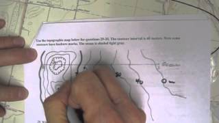
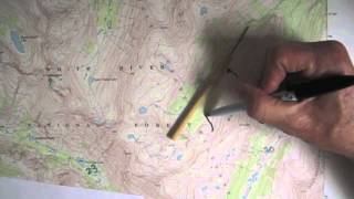
Determining the Topographic Profile (2)
GVSU HSAG
2,97 тыс. подписчиков
Скачать
77 видео с канала:
GVSU HSAG
Determining the Topographic Profile (2)
Скачать
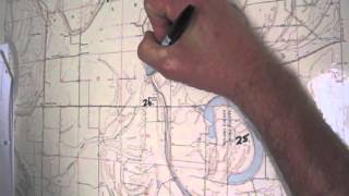
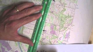
Determining the Contour Interval and Elevation
Скачать
Determining a Topographic Profile (1)
Скачать
Understanding Elevation on a Topographic Map
Скачать
Determining the Elevation
Скачать
Determining the Township, Range, Section, and Quadrant of the Section: Keo, Arkansas
Скачать
Identifying the Origin of a Lake
Скачать
Name the Channel Type
Скачать
Calculating Relief: Mount Jackson Quadrangle
Скачать
Measuring Distance: Mount Jackson Quadrangle
Скачать
Recognizing Features from a Topographic Profile 21
Скачать
Recognizing Features from a Topographic Profile 20
Скачать
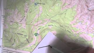
Identify the Geologic Feature: Mount Jackson Quadrangle
Скачать
Name the Geologic Feature Defined by a Narrow Ridge
Скачать
Name the Bowl-Shaped Geologic Feature
Скачать
Naming Geologic Features: Mount Jackson Quadrangle
Скачать
Recognizing Geologic Features: Mount Jackson Quadrangle
Скачать
Locate and Name the Water Feature Using Township and Range
Скачать
Locate and Name the Vegetation Feature Using Township and Range
Скачать
Calculating Gradient: Grandville Quadrangle
Скачать
Calculating Relief: Grandville Quadrangle
Скачать
Measuring Elevation Using Contour Lines
Скачать
Measuring Distance on a Topographic Map
Скачать
Converting Fractional Scale to Verbal Scale: Grandville, MI Quadrangle
Скачать
Speculating the Origin of Features on a Topographic Map
Скачать
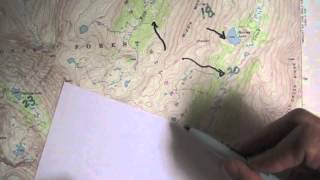
Recognizing Features on a Topographic Map
Скачать
Converting Fractional Scale to Verbal Scale: Whitewater, WI Quadrangle
Скачать
Reading Fractional Scale
Скачать
Hot, Cold, Warm, and Salt Water Density Model
Скачать
Hot, Cold, and Warm Water Density Model
Скачать
Hot and Cold Water Density Model
Скачать
Pumice Mammouth Lakes, CA
Скачать
Obsidian Flow Newberry Caldera, OR
Скачать
Paulina Peak Newberry Caldera, OR
Скачать
Devil's Postpile Mammouth Lakes, California
Скачать
Columnar Basalt North Central, OR
Скачать
Andesite Lava Flow Mount Hood, OR
Скачать
Identifying Sandstone
Скачать
Identifying Phyllite
Скачать
Identifying Pegmatite
Скачать
Identifying Olivine
Скачать
Identifying Metaconglomerate
Скачать
Identifying Magnetite
Скачать
Identifying Gneiss
Скачать
Identifying Fossiliferous Limestone
Скачать
Identifying Dolomite
Скачать
Identifying Calcite
Скачать
Identifying Basalt Porphyry
Скачать
Identifying Breccia
Скачать
Retention Pond Scenario
Скачать
Levee Scenario
Скачать
Parking Lot Scenario
Скачать
Wetland Flood Scenario
Скачать
Identifying Slate
Скачать
Identifying Shale
Скачать
Identifying Schist
Скачать
Identifying Rhyolite
Скачать
Identifying Rhyolite Porphyry
Скачать
Identifying Quartzite
Скачать
Identifying Quartz
Скачать
Identifying Pumice
Скачать
Identifying Marble
Скачать
Identifying Gabbro
Скачать
Identifying Granite
Скачать
Identifying Gypsum
Скачать
Identifying Diorite
Скачать
Identifying Conglomerate
Скачать
Identifying Coal
Скачать
Identifying Chalcedony
Скачать
Identifying Basalt
Скачать
Identifying Andesite
Скачать
HSAG Calculating Groundwater Velocity Unconfined Aquifer
Скачать
HSAG Calculating Groundwater Velocity Confined Aquifer
Скачать
HSAG Lake Contamination Experiment
Скачать
HSAG Groundwater Model Confined Aquifer
Скачать
HSAG Groundwater Model Lake Contamination
Скачать
HSAG Groundwater Model Unconfined Aquifer
Скачать
Канал: GVSU HSAG
Determining the Topographic Profile (2)
Скачать
Determining the Contour Interval and Elevation
Скачать
Determining a Topographic Profile (1)
Скачать
Understanding Elevation on a Topographic Map
Скачать
Determining the Elevation
Скачать
Determining the Township, Range, Section, and Quadrant of the Section: Keo, Arkansas
Скачать
Identifying the Origin of a Lake
Скачать
Name the Channel Type
Скачать
Calculating Relief: Mount Jackson Quadrangle
Скачать
Measuring Distance: Mount Jackson Quadrangle
Скачать
Recognizing Features from a Topographic Profile 21
Скачать
Recognizing Features from a Topographic Profile 20
Скачать
Identify the Geologic Feature: Mount Jackson Quadrangle
Скачать
Name the Geologic Feature Defined by a Narrow Ridge
Скачать
Name the Bowl-Shaped Geologic Feature
Скачать
Naming Geologic Features: Mount Jackson Quadrangle
Скачать
Recognizing Geologic Features: Mount Jackson Quadrangle
Скачать
Locate and Name the Water Feature Using Township and Range
Скачать
Locate and Name the Vegetation Feature Using Township and Range
Скачать
Calculating Gradient: Grandville Quadrangle
Скачать
Calculating Relief: Grandville Quadrangle
Скачать
Measuring Elevation Using Contour Lines
Скачать
Measuring Distance on a Topographic Map
Скачать
Converting Fractional Scale to Verbal Scale: Grandville, MI Quadrangle
Скачать
Speculating the Origin of Features on a Topographic Map
Скачать
Recognizing Features on a Topographic Map
Скачать
Converting Fractional Scale to Verbal Scale: Whitewater, WI Quadrangle
Скачать
Reading Fractional Scale
Скачать
Hot, Cold, Warm, and Salt Water Density Model
Скачать
Hot, Cold, and Warm Water Density Model
Скачать
Hot and Cold Water Density Model
Скачать
Pumice Mammouth Lakes, CA
Скачать
Obsidian Flow Newberry Caldera, OR
Скачать
Paulina Peak Newberry Caldera, OR
Скачать
Devil's Postpile Mammouth Lakes, California
Скачать
Columnar Basalt North Central, OR
Скачать
Andesite Lava Flow Mount Hood, OR
Скачать
Identifying Sandstone
Скачать
Identifying Phyllite
Скачать
Identifying Pegmatite
Скачать
Identifying Olivine
Скачать
Identifying Metaconglomerate
Скачать
Identifying Magnetite
Скачать
Identifying Gneiss
Скачать
Identifying Fossiliferous Limestone
Скачать
Identifying Dolomite
Скачать
Identifying Calcite
Скачать
Identifying Basalt Porphyry
Скачать
Identifying Breccia
Скачать
Retention Pond Scenario
Скачать
Levee Scenario
Скачать
Parking Lot Scenario
Скачать
Wetland Flood Scenario
Скачать
Identifying Slate
Скачать
Identifying Shale
Скачать
Identifying Schist
Скачать
Identifying Rhyolite
Скачать
Identifying Rhyolite Porphyry
Скачать
Identifying Quartzite
Скачать
Identifying Quartz
Скачать
Identifying Pumice
Скачать
Identifying Marble
Скачать
Identifying Gabbro
Скачать
Identifying Granite
Скачать
Identifying Gypsum
Скачать
Identifying Diorite
Скачать
Identifying Conglomerate
Скачать
Identifying Coal
Скачать
Identifying Chalcedony
Скачать
Identifying Basalt
Скачать
Identifying Andesite
Скачать
HSAG Calculating Groundwater Velocity Unconfined Aquifer
Скачать
HSAG Calculating Groundwater Velocity Confined Aquifer
Скачать
HSAG Lake Contamination Experiment
Скачать
HSAG Groundwater Model Confined Aquifer
Скачать
HSAG Groundwater Model Lake Contamination
Скачать
HSAG Groundwater Model Unconfined Aquifer
Скачать