How to Digitizing Polygons in ArcMap Using Feature Construction | ArcGIS | 17 GIS Schools 3,92 тыс. подписчиков Скачать
How to Import and Export GPS (.gpx) data & design Geodatabase | ArcGIS | Part 13 | @GISSchools Скачать
ArcMap Essentials: ArcCatalog, Geospatial Data, REST Services, and APIs | ArcGIS | 9 | @GISSchools Скачать
ArcMap Tutorial: Geocoding, Measuring, and DataFrame Properties | ArcGIS Course | 4 | @GISSchools Скачать
A Web App using GeoServer Services with Input Filters & Legend | GeoServer: Complete Project | 9 Скачать
GeoServer Dynamic Web Service with Parameterized SQL Views | GeoServer: Tutorial | 7 | @GISSchools Скачать
GeoServer Layers Publish from the PostGIS with Custom Style | GeoServer Tutorial | 6 | @GISSchools Скачать
Overlay GeoServer Web Service WMS on Google Earth Pro | GeoServer: Tutorial | 5 | @GISSchools Скачать
GeoServer HTTP request and Layer Preview Parameter | GeoServer: Complete Tutorial | 4 | @GISSchools Скачать
QField for Beginners: Easy Mobile Data Collection with QGIS (No Coding Needed) | 1 | @GISSchools Скачать
How to Add Geometry to a Feature Using the INSERT Statement in PostGIS with QGIS | 21 | @GISSchools Скачать
Step-by-Step: Create Spatial Tables & Add Geometry Columns in PostGIS with QGIS | 19 | @GISSchools Скачать
How to Handel Spatial Relationships of GIS Objects in PostGIS | PostgreSQL | 16 | @GISSchools Скачать
Spatial Reference ID and Geometry Field in PostGIS | PostgreSQL, QGIS | Part 12 | @GISSchools Скачать
The CASE Statement, DataType and Operators in Postgres | PostGIS, QGIS | Part 11 | @GISSchools Скачать
Multi Table Joins in PostgreSQL | Learn Spatial DB with PostGIS, QGIS | Part 10 | @GISSchools Скачать
Aggregate Functions and GROUP BY | Learn Spatial DB with PostGIS, QGIS | Part 9 | @GISSchools Скачать
Working with PostGIS By using pgAdmin and QGIS DB Manager | Part 5 | Eng Subtitles | @GISSchools Скачать
How to Import/Export Shapefile into Databases with PostGIS Manager | Part 3 | English Subtitles Скачать
How to Install PostGIS | Learn Spatial Databases with PostGIS and QGIS | Part 2 | English Subtitles Скачать
How to Install PostgreSQL | Learn Spatial Databases with PostGIS and QGIS | Part 1 | Eng Subtitles Скачать
Network Visualization and Routing with QGIS | GIS Network Analysis Tutorial | 27 | @GISSchools Скачать
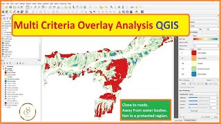
Multi Criteria Overlay Analysis with QGIS: A Comprehensive Geospatial Tutorial | 26 | @GISSchools Скачать
QGIS Model Builder for Streamlined Geospatial Workflows | Graphical Modeler | 25 | @GISSchools Скачать
Interpolating Point Data in QGIS | TIN Interpolation | Spatial Interpolation | 20 | @GISSchools Скачать
Mastering Nearest Neighbor Analysis with QGIS | Your Ultimate Geospatial Guide | 18 | @GISSchools Скачать
Time Series Animation Map in QGIS | An Absolute Beginner's Guide to QGIS 3 | 16 | @GISSchools Скачать
What is Variable in Python and How to Create Variables in Python | Multiple Values | @GISSchools Скачать
How to Georeference a Map (PDF/JPEG) in QGIS | Georeferencing a map using QGIS | 6 | @GISSchools Скачать
How to Mosaic Raster Datasets in QGIS | Raster Mosaicing and Clipping Tutorial | 3 | @GISSchools Скачать
How to Calculate Length of Shape file in QGIS | Measure Distance and Line Length | 1 | @GISSchools Скачать
Download 0.5m High-Resolution Georeferenced Google Satellite Images for Free in QGIS | @GISSchools Скачать
Mobile Survey App with QField in QGIS just in 5 Min - No Coding Required | Data Collection App Скачать
HTML Forms | Get Attribute Input Values | Submit Data to PHP with GET, POST Request | @GISSchools Скачать
Create a New Table in PostGIS with QGIS DBManager | Digitizing in Live Database | @GISSchools Скачать
How to Create Spatial DB in PostGIS | PostgreSQL | Import Shapefile into the Database | @GISSchools Скачать