Главная
Клипы
Новинки
Тренды
Популярные
Лайки
Комментарии
Все категории
Музыка
Фильмы
Видеоигры
Транспорт
Животные
Спорт
Путешествия
Люди и блоги
Юмор
Развлечения
Политика
Хобби
Образование
Наука
Организации
Найти
Retirement Song for Steve Matchak
Marcos Luna
5,48 тыс. подписчиков
Скачать
97 видео с канала:
Marcos Luna
Retirement Song for Steve Matchak
Скачать
Geography Song 2017
Скачать
How to Calculate Future Energy Consumption
Скачать
How to Use ModelBuilder Part 7
Скачать
How to Use ModelBuilder Part 6
Скачать
How to Use ModelBuilder Part 5
Скачать
How to Use ModelBuilder Part 4
Скачать
How to Use ModelBuilder Part 3
Скачать
How to Use ModelBuilder Part 2
Скачать
How to Use ModelBuilder in ArcGIS to Automate Geoprocessing
Скачать
How to Analyze Bivariate Relationships in ArcGIS
Скачать
How to Analyze the Distribution of Datasets in ArcGIS
Скачать
How to Acquire and Map US Census data in ArcMap 10.3
Скачать
How to Acquire and Graph State Energy Consumption Data
Скачать
How to Build a Story Map Web Map Application
Скачать
How to Configure Pop-Ups for a Layer in a Web Map
Скачать
How to Add Data to a Web Map from a Table or CSV File
Скачать
How to Create and Add Data to a Web Map with Map Notes
Скачать
How to Create and Share a Basic ESRI Web Map
Скачать
Overview of ESRI Online Story Maps
Скачать
How to Record and Share a Tour in Google Earth
Скачать
How to Save and Share Placemarks in Google Earth
Скачать
Adding Images to GE from Flickr and Video from YouTube
Скачать
Adding Facebook Images to Google Earth and Resizing Images
Скачать
How to Add a Placemark with Text and Images in Google Earth
Скачать
Submitting the SSU Map Georeferencing Assignment
Скачать
Geography Day 2015 "Geography Song"
Скачать
Identifying Populations at Risk from SLR
Скачать
Identifying Infrastructure At Risk - Pt3of3
Скачать
Identifying Infrastructure At Risk - Pt2of3
Скачать
Identifying Infrastructure At Risk - Pt1of3
Скачать
Understanding Coastal Flooding from SLR
Скачать
How to Model Coastal Flooding in ArcGIS
Скачать
How to map ACS data in ArcMap - Part 3 of 3
Скачать
How to map ACS data in ArcMap - Part 2 of 3
Скачать
How to map ACS data in ArcMap - Part 1 of 3
Скачать
How to Acquire and Graph Energy Intensity Data
Скачать
Creating a Raster Elevation Map - Pt 4 of 4
Скачать
Creating a Raster Elevation Map - Pt 3 of 4
Скачать
Creating a Raster Elevation Map - Pt 2 of 4
Скачать
Creating a Raster Elevation Map - Pt 1 of 4
Скачать
How Much Water is in a Cloud?
Скачать
How to calculate fog formation
Скачать
How Long Will It Take a Rain Drop to Fall From a Cloud?
Скачать
Energy as a Natural Resource
Скачать
How to Download American Community Survey (ACS) Data
Скачать
How to Georeference a Map in MapCruncher - Part 2 of 2
Скачать
How to Georeference a Map in MapCruncher - Part 1 of 2
Скачать
Intro to GPH904 and Spring 2015 Project Part 1 of 2
Скачать
Intro to GPH904 and Spring 2015 Project - Part 2
Скачать
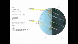
Calculating Noon Sun Angle
Скачать
Seasons, Sun Angle, and Latitude
Скачать
Intro to W&C Spring 2015 Pt2
Скачать
Introduction to W&C Spring 2015 Pt1
Скачать
How to Calculate Relative Humidity
Скачать
How to Calculate Dew Point
Скачать
Calculating Adiabatic Changes in Temperature and Humidity
Скачать
How to Compute Monthly Means in Excel
Скачать
How to Compute Heating and Cooling Degree Days in Excel
Скачать
How to Create a Graph of Weather Data in Excel
Скачать
Geography Song at Geography Day 2014
Скачать
Identifying Clusters 2 - Cluster and Outlier Analysis in ArcGIS 10.2
Скачать
Identifying Clusters 3 - Cluster Analysis with Polygon Features in ArcGIS 10.2
Скачать
Identifying Clusters 4 - Cluster Analysis of Incident Points in ArcGIS 10.2
Скачать
Identifying Clusters 1 - Introduction to Cluster Analysis in ArcGIS 10.2
Скачать
Overview of MultiSpec
Скачать
Deriving Slope in Google Earth
Скачать
Digital Representations of Terrain
Скачать
Elevation and Slope
Скачать
Making a Map in ArcMap 1
Скачать
Making a Map in ArcMap 2
Скачать
Understanding Map Scale
Скачать
Map Types 1
Скачать
Map Types 2
Скачать
Intro to Spatial Queries2
Скачать
Intro to Spatial Queries1
Скачать
Compound Attribute Queries as Sets
Скачать
Compound Attribute Queries
Скачать
Intro to Attribute Queries
Скачать
Intro to GIS Analysis
Скачать
Intro to ArcGIS 2 - Attributes
Скачать
Intro to ArcGIS 1 - ArcMap
Скачать
How to Peer Review Georef Assignment
Скачать
Save georef image in MapCrucher and zip files
Скачать
Position Determination3 - Using GPS
Скачать
Position Determination2 - Trilateration with GPS
Скачать
Position Determination1 - From Ancient to Modern
Скачать
Discussions in Canvas
Скачать
Working with DMS & DD in a GCS
Скачать
Some Guidance on Direction
Скачать
Time and Longitude
Скачать
Primer on Projections vb
Скачать
Projected Coordinate Systems
Скачать
More on Projections
Скачать
GCS Recap, Longitude, and Time
Скачать
Geographic Coordinate System
Скачать
Course Intro and Orientation
Скачать
Канал: Marcos Luna
Retirement Song for Steve Matchak
Скачать
Geography Song 2017
Скачать
How to Calculate Future Energy Consumption
Скачать
How to Use ModelBuilder Part 7
Скачать
How to Use ModelBuilder Part 6
Скачать
How to Use ModelBuilder Part 5
Скачать
How to Use ModelBuilder Part 4
Скачать
How to Use ModelBuilder Part 3
Скачать
How to Use ModelBuilder Part 2
Скачать
How to Use ModelBuilder in ArcGIS to Automate Geoprocessing
Скачать
How to Analyze Bivariate Relationships in ArcGIS
Скачать
How to Analyze the Distribution of Datasets in ArcGIS
Скачать
How to Acquire and Map US Census data in ArcMap 10.3
Скачать
How to Acquire and Graph State Energy Consumption Data
Скачать
How to Build a Story Map Web Map Application
Скачать
How to Configure Pop-Ups for a Layer in a Web Map
Скачать
How to Add Data to a Web Map from a Table or CSV File
Скачать
How to Create and Add Data to a Web Map with Map Notes
Скачать
How to Create and Share a Basic ESRI Web Map
Скачать
Overview of ESRI Online Story Maps
Скачать
How to Record and Share a Tour in Google Earth
Скачать
How to Save and Share Placemarks in Google Earth
Скачать
Adding Images to GE from Flickr and Video from YouTube
Скачать
Adding Facebook Images to Google Earth and Resizing Images
Скачать
How to Add a Placemark with Text and Images in Google Earth
Скачать
Submitting the SSU Map Georeferencing Assignment
Скачать
Geography Day 2015 "Geography Song"
Скачать
Identifying Populations at Risk from SLR
Скачать
Identifying Infrastructure At Risk - Pt3of3
Скачать
Identifying Infrastructure At Risk - Pt2of3
Скачать
Identifying Infrastructure At Risk - Pt1of3
Скачать
Understanding Coastal Flooding from SLR
Скачать
How to Model Coastal Flooding in ArcGIS
Скачать
How to map ACS data in ArcMap - Part 3 of 3
Скачать
How to map ACS data in ArcMap - Part 2 of 3
Скачать
How to map ACS data in ArcMap - Part 1 of 3
Скачать
How to Acquire and Graph Energy Intensity Data
Скачать
Creating a Raster Elevation Map - Pt 4 of 4
Скачать
Creating a Raster Elevation Map - Pt 3 of 4
Скачать
Creating a Raster Elevation Map - Pt 2 of 4
Скачать
Creating a Raster Elevation Map - Pt 1 of 4
Скачать
How Much Water is in a Cloud?
Скачать
How to calculate fog formation
Скачать
How Long Will It Take a Rain Drop to Fall From a Cloud?
Скачать
Energy as a Natural Resource
Скачать
How to Download American Community Survey (ACS) Data
Скачать
How to Georeference a Map in MapCruncher - Part 2 of 2
Скачать
How to Georeference a Map in MapCruncher - Part 1 of 2
Скачать
Intro to GPH904 and Spring 2015 Project Part 1 of 2
Скачать
Intro to GPH904 and Spring 2015 Project - Part 2
Скачать
Calculating Noon Sun Angle
Скачать
Seasons, Sun Angle, and Latitude
Скачать
Intro to W&C Spring 2015 Pt2
Скачать
Introduction to W&C Spring 2015 Pt1
Скачать
How to Calculate Relative Humidity
Скачать
How to Calculate Dew Point
Скачать
Calculating Adiabatic Changes in Temperature and Humidity
Скачать
How to Compute Monthly Means in Excel
Скачать
How to Compute Heating and Cooling Degree Days in Excel
Скачать
How to Create a Graph of Weather Data in Excel
Скачать
Geography Song at Geography Day 2014
Скачать
Identifying Clusters 2 - Cluster and Outlier Analysis in ArcGIS 10.2
Скачать
Identifying Clusters 3 - Cluster Analysis with Polygon Features in ArcGIS 10.2
Скачать
Identifying Clusters 4 - Cluster Analysis of Incident Points in ArcGIS 10.2
Скачать
Identifying Clusters 1 - Introduction to Cluster Analysis in ArcGIS 10.2
Скачать
Overview of MultiSpec
Скачать
Deriving Slope in Google Earth
Скачать
Digital Representations of Terrain
Скачать
Elevation and Slope
Скачать
Making a Map in ArcMap 1
Скачать
Making a Map in ArcMap 2
Скачать
Understanding Map Scale
Скачать
Map Types 1
Скачать
Map Types 2
Скачать
Intro to Spatial Queries2
Скачать
Intro to Spatial Queries1
Скачать
Compound Attribute Queries as Sets
Скачать
Compound Attribute Queries
Скачать
Intro to Attribute Queries
Скачать
Intro to GIS Analysis
Скачать
Intro to ArcGIS 2 - Attributes
Скачать
Intro to ArcGIS 1 - ArcMap
Скачать
How to Peer Review Georef Assignment
Скачать
Save georef image in MapCrucher and zip files
Скачать
Position Determination3 - Using GPS
Скачать
Position Determination2 - Trilateration with GPS
Скачать
Position Determination1 - From Ancient to Modern
Скачать
Discussions in Canvas
Скачать
Working with DMS & DD in a GCS
Скачать
Some Guidance on Direction
Скачать
Time and Longitude
Скачать
Primer on Projections vb
Скачать
Projected Coordinate Systems
Скачать
More on Projections
Скачать
GCS Recap, Longitude, and Time
Скачать
Geographic Coordinate System
Скачать
Course Intro and Orientation
Скачать