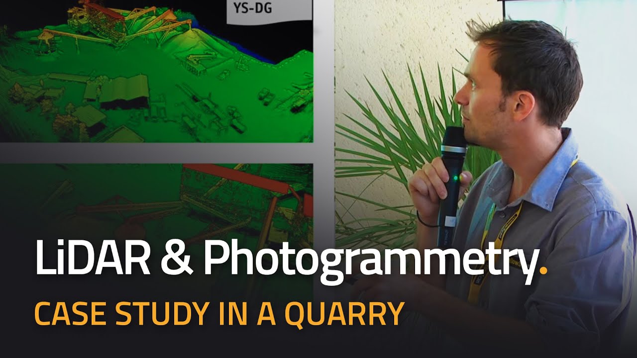
Conference on UAV LiDAR, Photogrammetry and TLS - Case Study in a Quarry (LiDAR for Drone 2017)
Pierre Chaponnière, Application Engineer at YellowScan, presents the benefits of Direct Georeferencing for simultaneous UAV LiDAR / photogrammetry systems versus traditional aerial triangulation in a quarry environment.
🔗 FOLLOW US ON OUR SOCIAL MEDIA
➜ Twitter: [ Ссылка ]
➜ Instagram: [ Ссылка ]
➜ LinkedIn: [ Ссылка ]
➜ Facebook: [ Ссылка ]
💛 SUBSCRIBE TO OUR CHANNEL
➜ [ Ссылка ]
📧 WANT TO KNOW MORE?
➜ Visit our website: [ Ссылка ]
➜ Contact us: contact@yellowscan-lidar.com
#LiDAR #UAV #pointcloud #Surveying #YellowScan