Zorats Karer (Armenian: Զորաց Քարեր, locally Դիք-դիք քարեր), also called Karahunj, Qarahunj or Carahunge and Carenish (Armenian: Քարահունջ և Քարենիշ) is a prehistoric archaeological site near the town of Sisian in the Syunik Province (Armenian: Սյունիք, Azerbaijani: Zangezur) of Armenia. The phrase Zorats Karer is literally translated from Armenian as Army Stones. It is also often referred as the Armenian Stonehenge.
In 2004,Zorats Karer was officially named the Karahunj (Carahunge).
Karahunj site is at a mountain plateau at an altitude of 1,770 metres and occupies an area of about 7 hectares on the left side of the canyon of the River Dar, a tributary of the river Vorotan (at 2 km). It is located on a rocky promontory near Sisian, Syunik Province.
Armenian historian Stepanos Orbelian, in his book History of Syunic (I—XII centuries) mentions that in the Tsluk (Yevalakh) region of Armenia, near the town Syunic or Sisian, was a village called Carunge, which means "stone treasure" or "foundation stones" in Armenian.
The name Carahunge is interpreted as deriving from two Armenian words: car (or kar) (Armenian: քար), meaning stone, and hunge or hoonch (Armenian: հունչ), meaning sound. Thus the name Carahunge means "speaking stones". This interpretation is related to the fact that the stones make whistling sounds on a windy day, presumably because of multiple reach-through holes bored into the stones.
Carahunge is also known in local lore as Zorats Karer (Զորաց Քարեր), Dik-dik Karer (Դիք-դիք քարեր), and Tsits Karer (Ցից Քարեր), meaning "vertical stones" in vernacular Armenian.
The Carahunge monument consists of the central circle, the north arm, the south arm, the N–E alley, the chord (crossing the circle) and separate standing stones.
Karahunj is rich with stone settings, burial cists and standing stones (menhirs). In total, 223 stones have been identified.
The heights (above ground) of the stones range from 0.5 to 3 m and they weigh up to 10 tons. They are basalt (andesite) stones, eroded by time and covered with moss and lichen of many colours. The inner surface of the holes is much better preserved. There are also many broken and unnumbered stones.
About 80 of the stones feature a circular hole, although only 37 of the stones, with 47 holes, are still standing. They have been of interest to Russian and Armenian archaeoastronomers who have suggested that the standing stones could have been used for astronomical observation. Seventeen of the stones were associated with observations of sunrise or sunset at the solstices and equinoxes, and 14 with the lunar extremes. However, this must remain conjectural as the holes are relatively unweathered and may not even be prehistoric in origin.
The astronomical significance of the megalithic structures at Zorats Karer was first explored by archaeologist Onik Khnkikyan in 1984. A year later, Armenian astrophysicist Elma Parsamyan hypothesised about the existence of an astronomical observatory at Zorats Karer (Carahunge), and analysed other megalithic sites at Metzamor and Angeghakot.
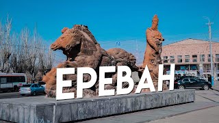
Sisian (Armenian: Սիսիան) is a town and the centre of the urban community of Sisian, in Syunik Province at the south of Armenia. Sisian is located on Vorotan River, 6 km south of the Yerevan-Meghri highway, at a road distance of 217 km southeast of the capital Yerevan, and 115 km north of the provincial centre Kapan.
As of the 2011 census, the population of the town was 14,894. As per the 2016 official estimate, the population of Sisian is around 12,900.
The area of present-day Sisian was also known as Sisakan and Sisavan during ancient times and later in the Middle Ages. According to Movses Khorenatsi, the name of Sisakan -and subsequently Sisian- was derived from Sisak, a legendary ancestor of the Armenian princely house of Syuni.
The Turkic name of Gharakilisa -meaning the black church referring to the town's 7th-century church of Saint Gregory- used between the 16th and the 20th centuries for the town, was kept until 1935, when the name Sisavan was restored. Finally in 1940, the town was renamed Sisian.
Sisian is located at the southeast of Armenia, in the mountainous region of historic Syunik. Surrounded with the Zangezur Mountains from the west and Bargushat Mountains from the south, Sisian is situated on the shores of Vorotan River, at an average height of 1600 above sea level, only 6 km south of the main highway that connect Armenia with the Republic of Nagorno Karabakh and Iran. Sisian river joins Vorotan at the southern border of the town.
The Sisian mountain pass north of the town is at a height of 2345 meters, connecting the Vorotan plain at the east with the plains of Nakhichevan at the west.
👉Follow me❤️:
📷Instagram: [ Ссылка ]
🎥Youtube: [ Ссылка ]
#Karahunj #sisian #Menhir