Jasper's North Boundary trail: 9-days SOLO Backpacking - 100 miles no re-supply & no other humans
The North Boundary Trail – The Grand Old Lady. This is a solo 155 km (100 mile) hike.
In the summer of 1910, a small party of European alpinists exploring the slopes of Mount Robson heard of an old Indian trail which led down the Smoky River, over a high pass and eastward along the Snake Indian River to its mouth in the Athabasca Valley. Thinking the route might offer a quick exit from the mountains, the group set off down the Smoky under the guidance of outfitter John Yates. With some expert route-finding by this veteran guide, the party made the first recorded traverse of today's North Boundary trail.
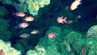
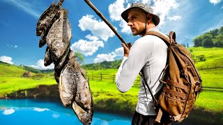
The North Boundary Trail has been drawing hikers to the wilds of north Jasper National Park for over 100 years. Much has changed over a century of use but the promise of pristine wilderness and the test of endurance still hold allure for many brave souls, myself included. I recently had the good fortune to hike from Berg Lake to Rock Lake along this famous route, a distance of 155 km (100 miles) in 9 days of solo adventure.
Walking the NB trail is like taking a step back in time. Seeing the warden cabins enroute you can’t help but wonder what it must have been like for those intrepid souls who used to live out there year round, patrolling their districts through the bug infested heat of summer and the seemingly endless cold of winter. How times have changed. Park staff now only conduct occasional visits, doing the best they can to keep the trails cleared and the ‘facilities’ functional. Most sections of the trail now see only a handful of visits in any given year.
0:00 Intro
1:04 Whitehorn Campground (km 10.5 / Night 1)
2:17 Emperor Falls
3:09 Berg Lake Campground (km 19.6 / Night 2)
7:03 Wolverine Campground
10:32 Wolverine Warden Cabin (km 41.4 / Night 3)
19:37 Chown Creek Campground
23:02 Lower Smoky Warden Station
24:36 Donaldson Campground (km 55.7 / Night 4)
26:49 Twintree Campground
33:10 Byng Warden Cabin (km 75.8 / Night 5)
37:29 Byng Campground
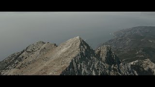
38:43 Snake Indian Pass (km 82.1 / 2,027 m)
41:37 Oatmeal Campground
43:05 Three Slides Campground (km 101.1 / Night 6)
50:36 Blue Creek Campground (km 116.1 / Night 7)
1:02:51 Willow Creek Warden Cabin (km 143.1 /Night 8)
1:12:45 Rock Lake trail head (km 155.1)
#NorthBoundaryTrail #Backpacking #Hiking #Mountains
My CalTopo map can be found here: [ Ссылка ]
Reference: Canadian Rockies Trail Guide, Brian Patton & Bart Robinson
[ Ссылка ]
Enjoy.
Marty
----------------------------