Geovariances develops and distributes a data connection between DecisionSpace® Geosciences and Isatis. DSG-Isatis plug-in is a great complement to DSG Earth Modeling embedded functionalities. It allows easy data movement between both softwares, making it easy for DSG users to benefit from Isatis extensive suite of geostatistical methods in their reservoir characterization workflow.
Demo contents:
We are going to export a poinset to Isatis. The poinset is displayed in DSG’s Cube view.
First we export this poinset to ISATIS. It contains unbloked well logs and properties. The one we are interested in is the porosity. To export data, select the DGS’s object, the Isatis project and folder.
The data appears in the Isatis’ tree after a refresh of the database.
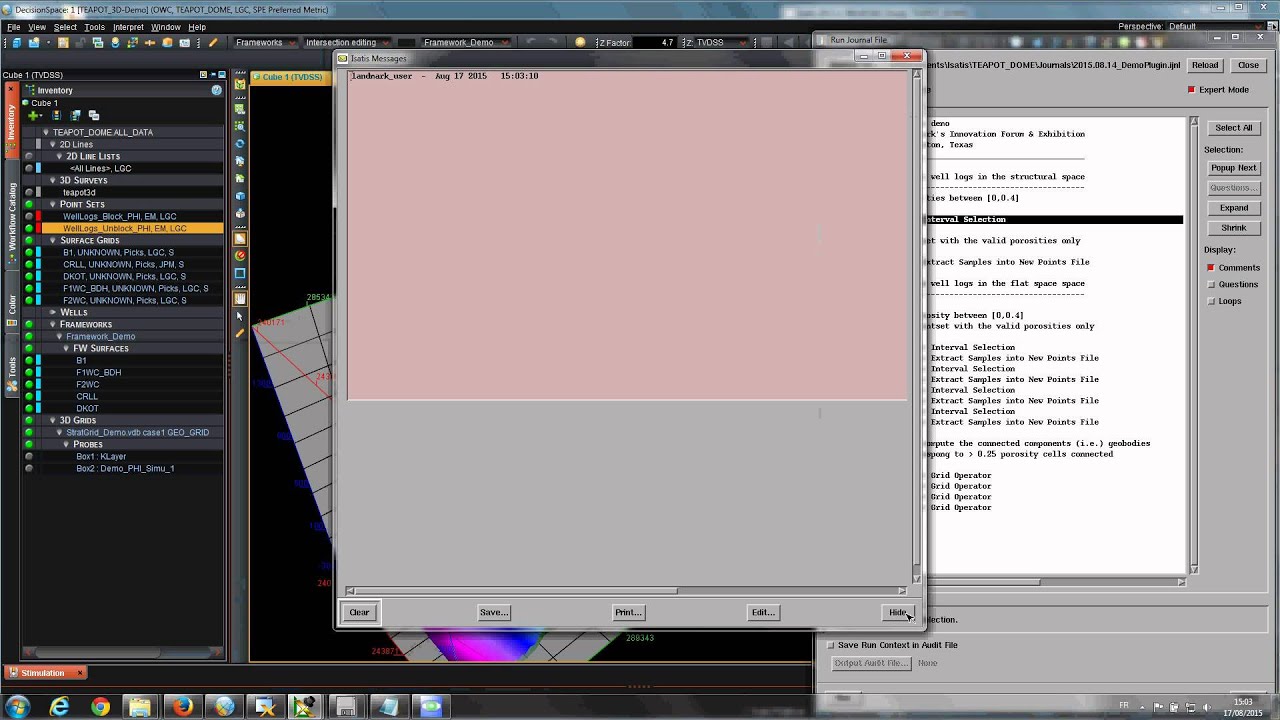
To QC the export we apply a selection (or subset) to the porosities to mask the invalid samples as it is done in DSG. We use an Isatis recorded workflow.
We visualize them in the Isatis 3D viewer, setting some displayed parameters for a better visual comparison with the DSG’s cube view.
The data are identical.
To check for a porosity compaction trend we can use Isatis’ Exploratory Data Analysis. The histogram is unimodal and slightly skewed toward small porosities. The depth vs porosity cross-plot doesn’t show a correlation between porosity and depth so there is no evidence of a compaction trend at this scale.