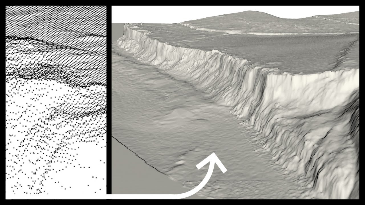
This video tutorial goes through the steps to import Lidar point cloud data into Rhino and convert this into a usable mesh or poly surface. This video utilises a script called 'ASCIIGridImporter.py' which can be acquired from here:
[ Ссылка ]
The key steps in this video can be found below:
00:00 - Introduction
00:23 - Acquiring lidar data from digimaps
01:38 - Using the 'ASCIIGridImporter.py' script using 'RunPythonScript'
02:25 - ASC file import options and mesh creation
04:45 - Generating contour lines from the mesh
Lidar data can be downloaded from:
[ Ссылка ]
[ Ссылка ]


![이지현 (Lee Jihyun) 모델 '치어리더 출신, HOT했던 포즈 타임' 에스알 (SR) [4K60P] 240908 Auto Salon Week 직캠](https://s2.save4k.ru/pic/JL9gE9Jzls4/mqdefault.jpg)


![Gojo Satoru - So Tired - Jujutsu Kaisen Season 2 Episode 4 - [EDIT/AMV] 4K](https://s2.save4k.ru/pic/L7u4rPNERKM/mqdefault.jpg)