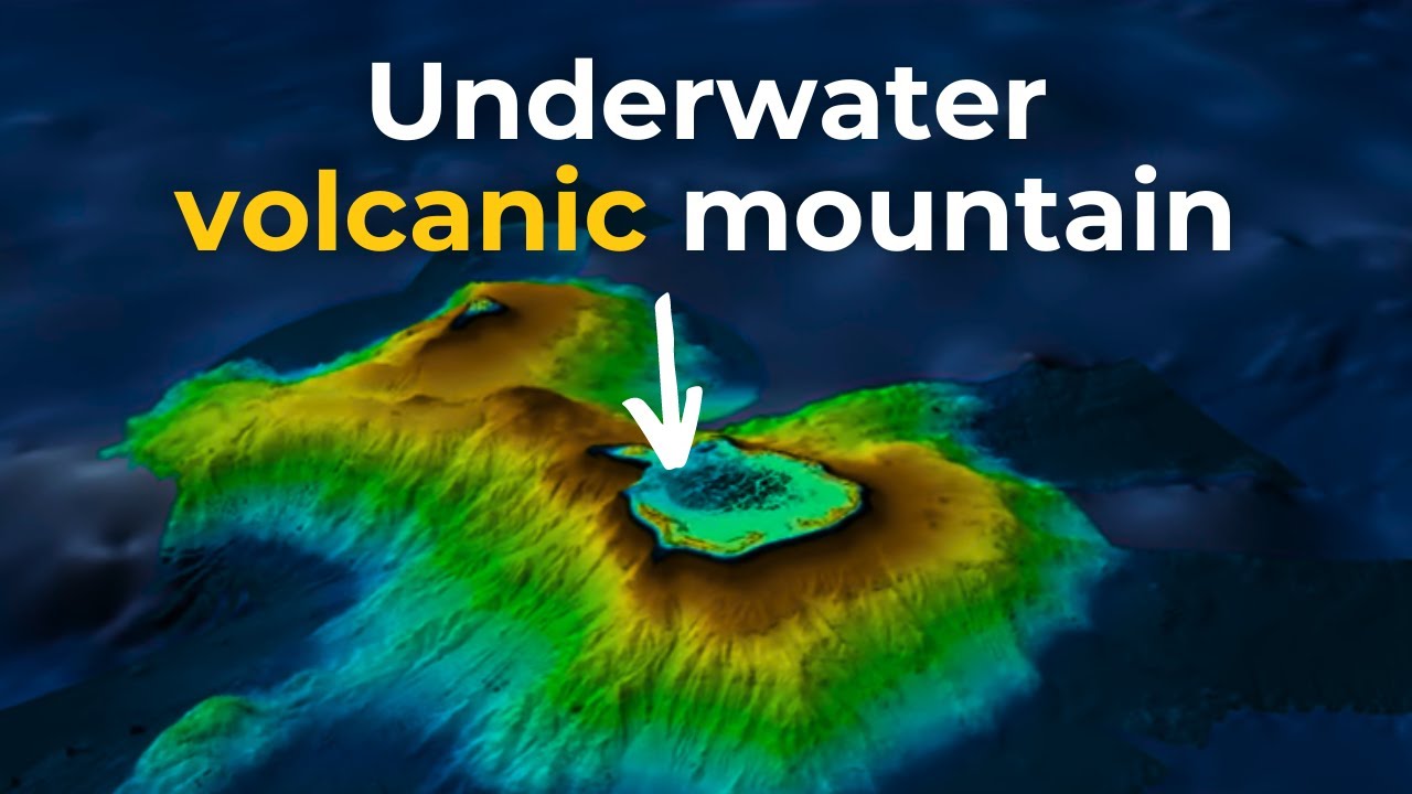
During October 2022, CSIRO research vessel (RV) Investigator completed the first high resolution mapping of the new Cocos (Keeling) Islands Marine Park. The mapping shows the Cocos (Keeling) Islands as the twin peaks of a massive seamount (underwater volcanic mountain) that lies beneath these idyllic tropical islands.
The mapping was completed during a 35-day voyage to survey biodiversity in the marine park and surrounds. The voyage was led by the Museums Victoria Research Institute in collaboration with Parks Australia, Bush Blitz, and Australian museums and research institutes.
The new imagery was produced on board RV Investigator during the voyage by combining the newly acquired CSIRO data with other existing datasets. This includes datasets from the Australian Hydrographic Office (LiDAR bathymetry-elevation), GEBCO2022 (background bathymetry) and Geoscience Australia-AusSeabed (background bathymetry). The 3D products were produced using QPS Fledermaus. RV Investigator captured the bathymetry using its gondola mounted Kongsberg EM122 multibeam echosounder.
Certain material in these mapping products is reproduced under licence by permission of The Australian Hydrographic Office. ©Commonwealth of Australia 2021. All rights reserved.