Just like with any other quest, a quest for lavish crop yields begins with a map.
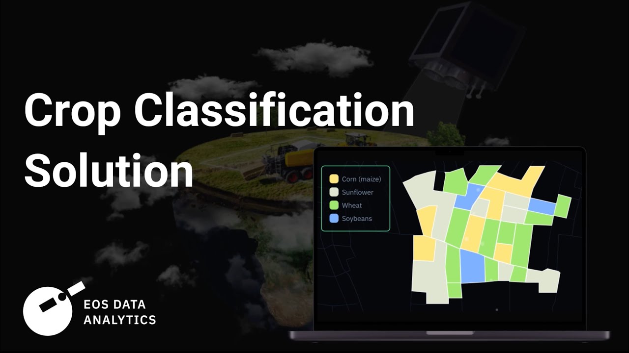
Making all the right management decisions and skyrocketing an agribusiness actually requires a whole bunch of maps, including a Crop Classification one – and that’s where a magical duo of satellites and scientists comes into play, replacing traditional ineffective methods.
By masterfully fusing satellite imagery, ground-truth data, and machine learning algorithms, EOSDA team sets a high standard in remote crop classification with up to 90% accuracy of the resulting maps.
Our custom solution spans multiple industries, delivering scalable geospatial insights to both public and private sectors. Whether you’re an agricultural insurer seeking ways to simplify claim validation or an input supplier eager to make your crop-specific product sales better targeted – either way, the benefits are plenty!