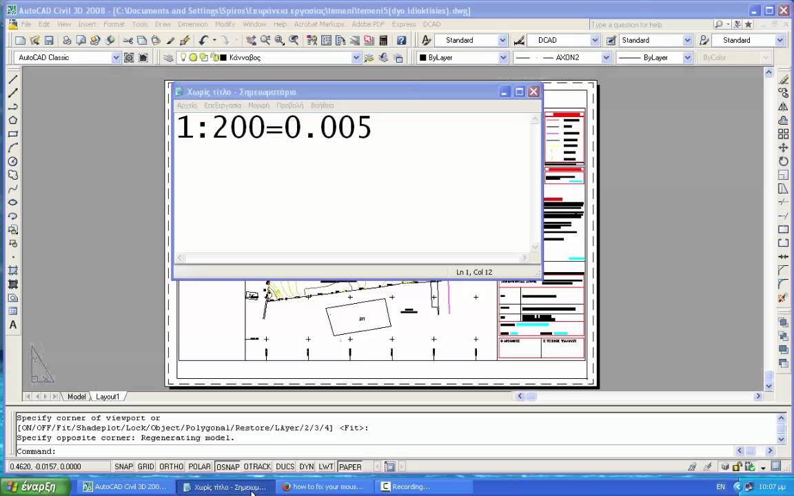
A simple way of creating scales (e.g. 1:200) in your Autocad drawings. Plot in layout using vewports and acquire your drawing in any scale you like (1:100, 1:200, 1:500,1:1000 1:2000, 1:5000 etc.)
Watch my other relevant videos:
Scale a georeferenced image in one Axis only(e.g. in case of a bad scanning)
[ Ссылка ]
Autocad: "Invisible" printing
[ Ссылка ]
Autocad: How to create .plt file after installing a plotter's configuration
[ Ссылка ]
ArcGIS: Manage .dwg files to ArcMap and convert to shapefiles(.shp)
[ Ссылка ]
ArcGIS: Plot in ArcMap (Import Scale, Grid, Legend, Scale Bar in layout)
[ Ссылка ]
Autocad: Convert a shapefile(.shp) to a .dwg and the opposite, georeferenced
[ Ссылка ]
Measure width and height of a photograph in pixels and resize it
[ Ссылка ]
View any forgotten passwords saved in your computer
[ Ссылка ]
Autocad:Display points from your country's coordinates to Google Earth
[ Ссылка ]
Autocad: Measure and divide a polyline to equal segments
[ Ссылка ]
Arc Gis: Insert Gps points in Arc Map and create shapefile
[ Ссылка ]


![Реакция Последней Реальности на Лололошку и Финал [ Райя, Окетра, Ло, Дилан, Ричард, JDH, Дана ]](http://i.ytimg.com/vi/mhVxBiYkSIg/mqdefault.jpg)


![4K BLACKPINK - BORN PINK TOUR ENCORE IN PARIS [ STADE DE FRANCE ] FULL CONCERT 2023](https://i.ytimg.com/vi/3T3ilt_xbLA/mqdefault.jpg)