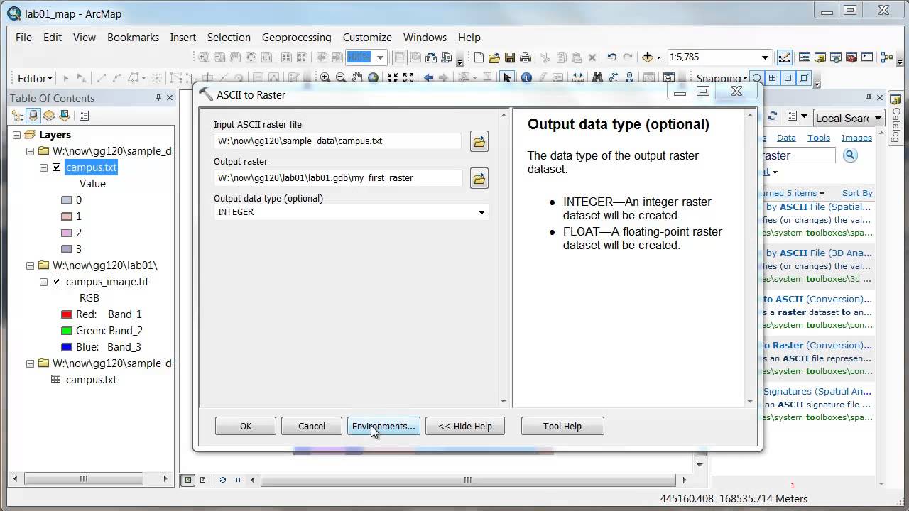
Use ASCII to Raster operation and create a raster file in the geodatabase from a text file. Define the environment parameters to inherit the spatial reference system of another image. If that doesn't work (it didn't in this case), define the spatial reference system through the properties of the new raster file in ArcCatalog.


![Искусство доколумбовой Америки / [История по Чёрному]](https://s2.save4k.ru/pic/xVPQq3tqlfs/mqdefault.jpg)